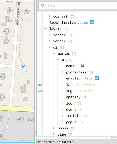
I am using ignition in my boat to monitor and control rpm speed music and a lot of other things. I am trying to use the perspective map to be able to track my position kind of like a car gps but no routes or anything just show my position at all times. I running this on a rasbperry pi 5 which i have gotten gps signal from a sim7600. I am sending the geolocation (longitude, lattitude) via mqtt to ignition and i am setting that as the values to a layer→ui→marker. Should this work? Or is this not possible? The reason I am asking is i have tested it and it seems to be very delayed but I am not sure if the issue is with something Im doing in ignition or my python code that is sending the location or both.
How long is the delay you are experiencing?
It's pretty long I would say 5 - 10 minutes
This is excessive, how long does it take for the MQTT values to update?
I am publishing the GPS data from my python code every 0.1 seconds.
Normally, if the data makes it into Ignition I would expect less than a second delay.
Have you verified the data changes immediately in the tag when you move the GPS?
I haven’t hard to manipulate it where it is mounted. I am thinking the issue is probably in my code or my gps module itself. Just curious if the setup I have within Ignition is correct for what I am trying to do?
Seems like the Ignition side should work as is.
Ok thanks I will have to do some checking on my end. One other question. Other than tag groups is there any way to change the scan time of the mqtt values?
MQTT doesn’t by definition have a scan time.
It is effectively event based.
The driver that connects the OPCUA server in Ignition to the MQTT will have a poll rate or a subscription that responds to events. If it has a poll rate, normally that will be affected by the tag groups. If it is event based, it may not be affected by the tag groups.
Ok thank you for your help.
